
 雅虎香港電視
 Newly Released Footage Shows Mauna Loa Eruption as Seen From Satellite
1 年前
The National Oceanic and Atmospheric Administration (NOAA) released a compilation of satellite imagery of the eruption of Hawaii’s Mauna Loa volcano on Tuesday, December 6.
On Tuesday, the NOAA posted satellite imagery, which they said was captured on Monday, November 28, when the volcano erupted on Hawaii’s Big Island.
The satellites are used to monitor “the ongoing eruption, lava flow, ash plume, and sulfur dioxide emissions,” the NOAA said.
Officials reported that Mauna Loa continued to erupt with fissures feeding lava flows on Tuesday, December 6. Credit: NOAA Satellites via Storyful
相關影片推薦
1:51
奧運男足賽果風波 國際足協裁判員導師︰暫停兩小時不理想需考慮重賽now.com 影音新聞73,980 次觀看・1 天前 3:23【娛樂訪談】魯文傑自爆當日離開TVB:我真係驚Yahoo OMG Videos16,697 次觀看・14 小時前
 0:32《男航女機師》前導預告Yahoo Movies HK36,222 次觀看・18 小時前
0:49
醫管局總行政經理莊慧敏盜竊罪成上訴 兩個月內裁決now.com 影音新聞25,379 次觀看・18 小時前 4:15【娛樂訪談】 「舞台劇獎最佳男主角」魯文傑:當年哥哥張國榮叫我試鏡Yahoo OMG Videos51,755 次觀看・1 天前
 2:35《變形金剛初始篇》次回預告Yahoo Movies HK7,116 次觀看・20 小時前
熱門必看
- 3:23【娛樂訪談】魯文傑自爆當日離開TVB:我真係驚Yahoo OMG Videos16,638 次觀看・14 小時前
 0:07動漫節 2024「反智轉身」再現Yahoo Video HK35,957 次觀看・19 小時前
- 4:15【娛樂訪談】 「舞台劇獎最佳男主角」魯文傑:當年哥哥張國榮叫我試鏡Yahoo OMG Videos51,754 次觀看・1 天前
 6:31鄭秀文演唱會|第9場網傳「待定」嘉賓揭曉 林峯收巨型叉燒飯 預告明年紅館開騷Yahoo OMG Videos36,823 次觀看・2 天前
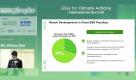 12:02ESG Xchange 2024: Paths for Chinese Cross-Border Enterprises to Achieve ESGYahoo Video HK5,152 次觀看・3 天前